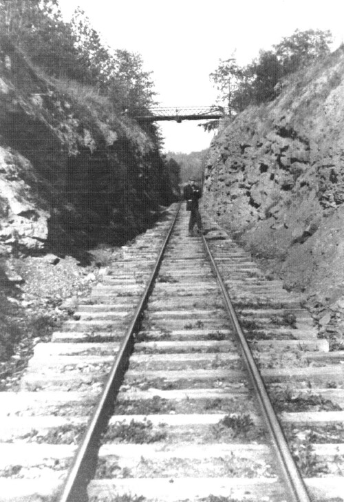
Known locally as
the Rock Cut, this section of the narrow-gauge railroad track was
subsequently widened and made a part of the roadbed for Ohio Route # 78. The Rock Cut is located about 1 miles
east of Lewisville, Ohio. The bridge
over the rock cut was part of the former Route # 78 that wound around hills and
valleys before assuming the railroad bed after the narrow-gauge ceased
operation. A loop of the old Route #
78, about miles long, still exists as an unpaved road that connects with Summit
Township road, T-272. The township
road, T-272, was formerly called Sixteen because 16 independent families of
the Weber line lived there.
Photo provided by Dennis and Ruth Weber
Click here for the Short-Cut Table of Contents