MAPS of AREA NEAR JOHNSTON
SCHOOL
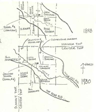
Map of the Johnston School
Site and Surrounding Area
The
Johnston School stood within Center Township near the borders of Center, Malaga
and Summit Townships. The above are two
maps, 1898 and 1980, prepared by Paul E. Young based on historical data. Click
here to return to the photo of Johnston School Site
or the Sketch of the school.
Photograph
provided by Paul E. Young, Jr. -- e-mail: young.13@osu.edu